How To Arrive
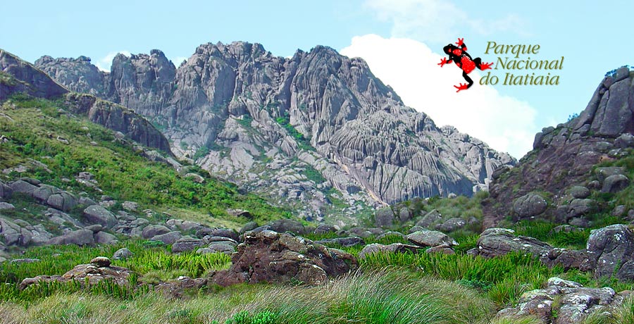
| The Itatiaia National Park is located between the states of Rio de Janeiro and Minas Gerais, near the state of São Paulo, in the Mantiqueira Mountains.
In the South Fluminense region, also known as the Agulhas Negras region, the National Park includes the cities of Itatiaia and Resende. In southern Minas Gerais the park includes the cities of Itamonte and Bocaina de Minas. Geographically, it is located between parallels 22 º 19 'and 22 º 45' south latitude and median 44 º 15 'and 44 º 50' longitude. |
|
Administrative seat of the Park (lower regions)
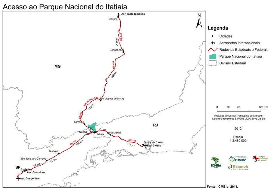
Starting from Rio de Janeiro or Sao Paulo, the visitor should follow the Presidente Dutra Highway (BR 116) to the town of Itatiaia, at km 318. The trip takes about 2h 30min from Rio de Janeiro and 3 hours from Sao Paulo.
Plateau Region
Departing from Rio de Janeiro or Sao Paulo, the visitor should follow the Presidente Dutra Highway (BR 116) to Engenheiro Passos at Km 330. From this point follow the BR 354 highway in the direction of Caxambú for 26.5 km, to a place known as Garganta do Registro at an altitude of 1.669 meters. From there, 14 km of dirt road leads to the Marcão station, and another 3 km will take you to the Rebouças Shelter.
Below is a table with the distances to the two entrances to the park, gate 1 and the Marcão gate. The first part of the list refers to the distance from the three major metropolitan centers of the region, São Paulo, Rio de Janeiro and Belo Horizonte. The second part lists the cities near the park where visitors can find hotels and hostels, as well as reference points for access to the Itatiaia Park.
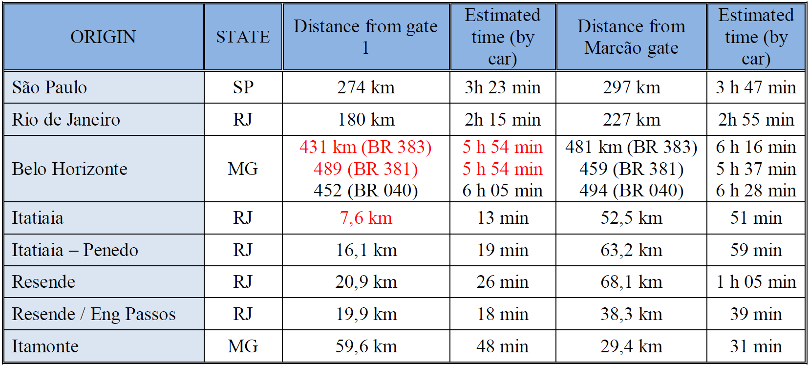
Source: Google Maps (http://maps.google.com/maps?ct=reset)
The bus terminals nearest the park are in Resende and Itatiaia at 24 km and 5km, respectively, from the entrance to the Lower Region of the park. In the center of Itatiaia city, there is a circular bus that goes to the park.
There is no regular bus line to access the Plateau region of the park. From the Resende Bus Station visitors can take a bus to Caxambu / MG and get off early at the Garganta do Registro (the border between the states of Rio and Minas). From this point to the Marcão gate is 14 km of dirt road (uphill).
Bus: Bus Routes and Schedules
BUS ROUTE ITATIAIA X NACIONAL PARK - Viação Penedo (24) 3381-8861
Departures from downtown to Visitors Center - 07:00a.m / 12:00p.m / 3:00p.m / 6:00p.m
Departures from downtown to National Park entrance - 10:20a.m
Departures from National Park entrance to downtown - 11:00a.m
Departures from National Park Visitors Center to downtown - 08:00a.m / 1:00p.m / 5:00p.m / 7:00p.m