Jalapão region is located on the eastern part of Tocantins state, it is boundary of with the states of Bahia, Piauí and Maranhão. Originally this area features 43,881.14 km2, comprising 10 municipalities on Cerrado biome. For the scope of Jalapão Region Ecological Corridor Project, it was established a Target Area where shall be conducted surveys diagnostics in order to understand the region socio-economic and environmental potentials as a whole. This target area boasts 19 municipalities located among the states of Bahia, Maranhão, Piauí and Tocantins, featuring 81,546.93 km2 of total area as listed below:
- 3 municipality in Bahia: Formosa do Araguaia, Santa Rita de Cássia e Mansidão;
- 1 municipality in Maranhão: Alto Parnaíba;
- 5 municipalities in Piauí: Barreiras do Piauí, Corrente, Gilbués, Santa Filomena, and São Gonçalo da Gurguéia;
- 10 municipalities in Tocantins: Almas, Lagoa do Tocantins, Lizarda, Mateiros, Novo Acordo, Ponte Alta do Tocantins, Rio da Conceição, Rio Sono, Santa Tereza do Tocantins and São Félix do Tocantins.
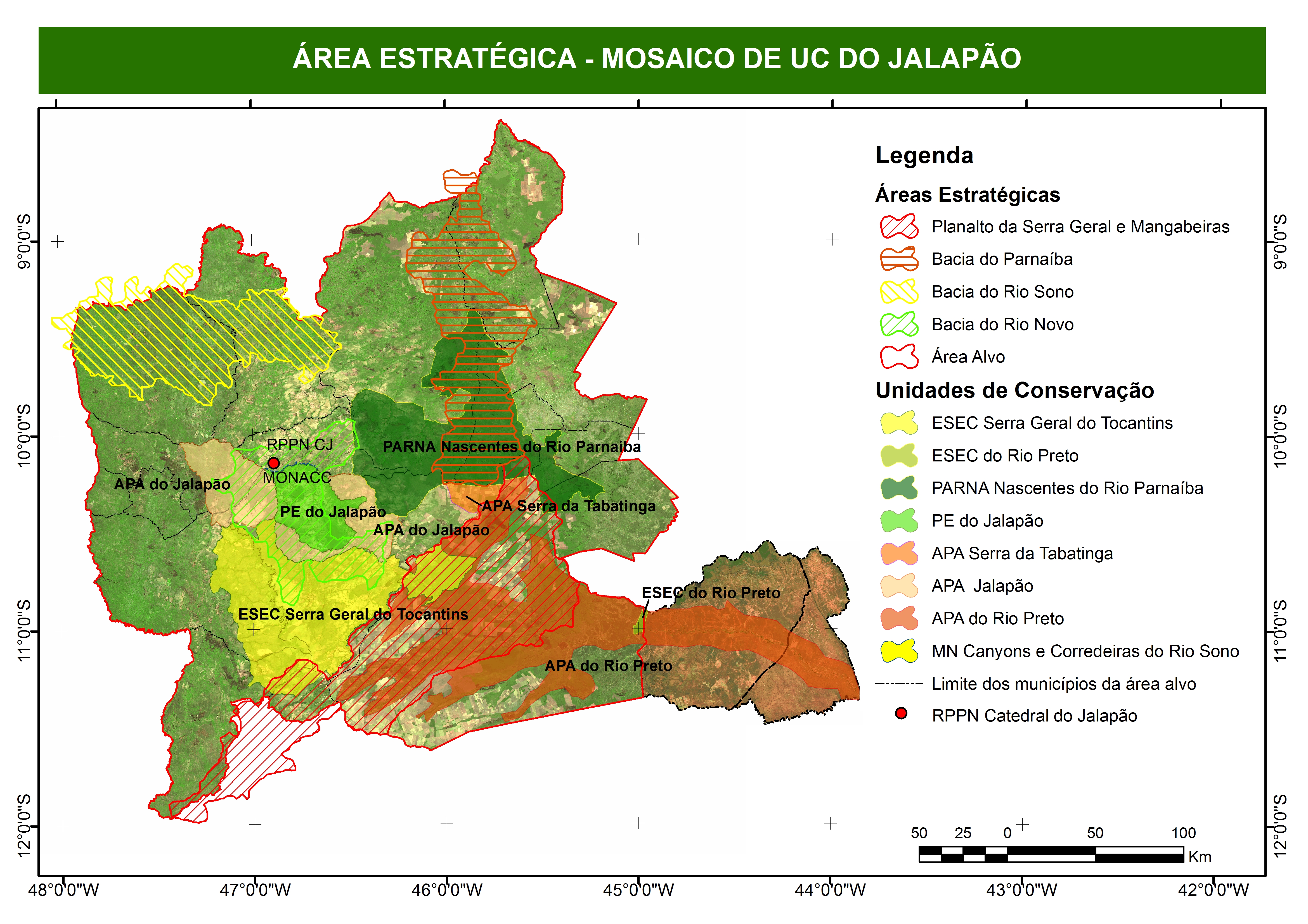
The figure below shows the boundaries of the target area and UCs, which are the focus of the project:
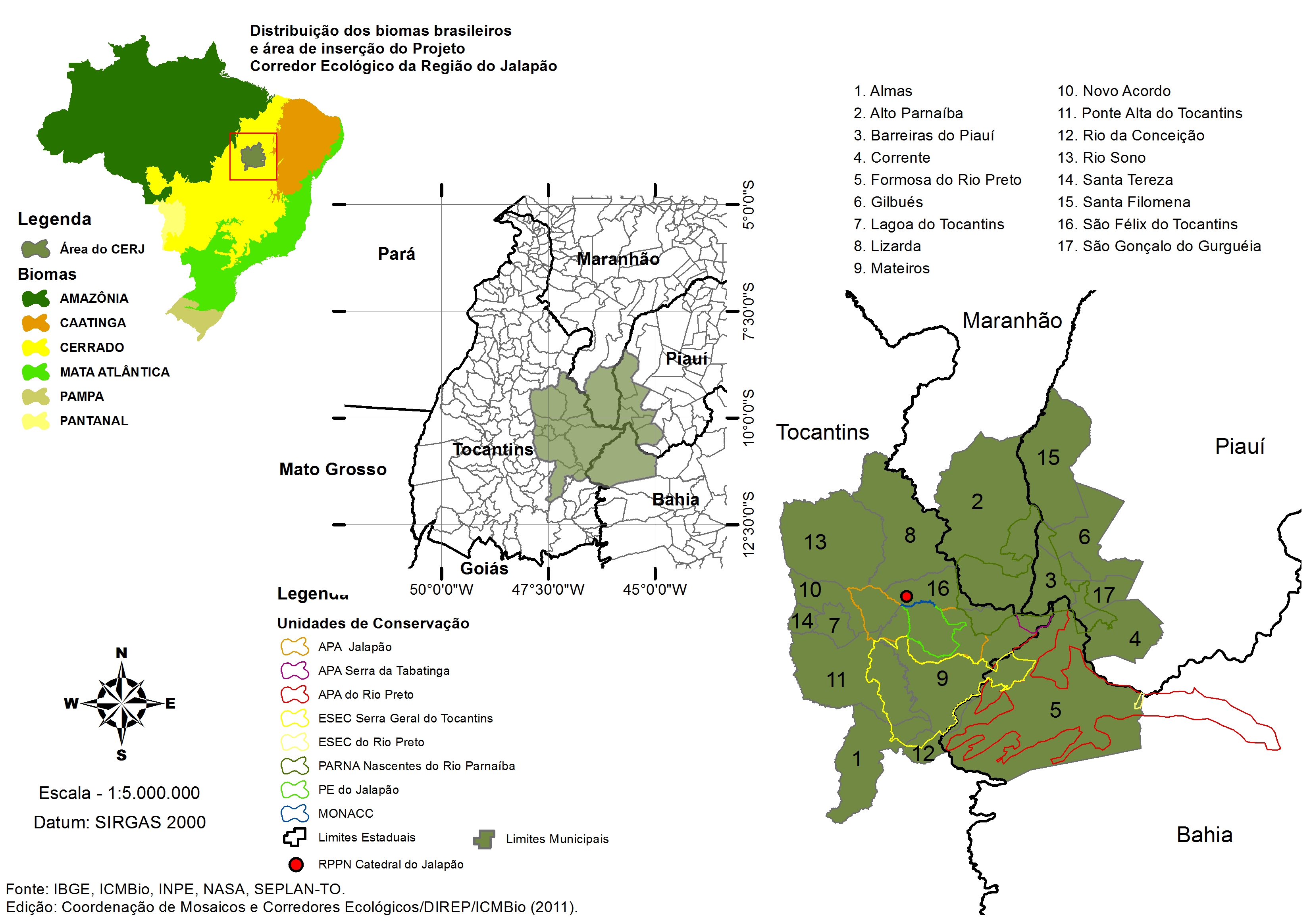
The Target Area Project was a function of buffer zones and a distance of 10 km from the confinesof the five protected areas in the region of Jalapao, which are hotbeds of implementation of the Ecological Corridor:
Federal Conservation Units:
- Área de Proteção Ambiental Serra da Tabatinga;
- Estação Ecológica Serra Geral do Tocantins (EESGT);
- Parque Nacional das Nascentes do Rio Parnaíba (PNNP).
State Conservation Units:
- Área de Proteção Ambiental do Jalapão (APAJ);
- Área de Proteção Ambiental do Rio Preto;
- Estação Ecológica do Rio Preto;
- Parque Estadual do Jalapão (PEJ).
")
")