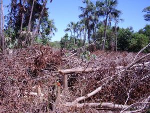
At the time of its discovery, the vegetation of Brazil was characterized by forested areas, covering about 90% of its territory. They were represented in the categories equatorial, tropical, subtropical, savannas and scrublands. The remaining 10% were primarily grassland formations (Magnanini, 1961, Mizuguchi et al., 1981). In the Cerrado Biome, data on the state of the vegetation point to a loss of native vegetation between 38,9% (MMA/SBF, [sd]) and 54,9% by the year 2002 (MACHADO et al., 2004).

In the study area, deforestation is also present, though less evident than in their immediate surroundings. Deforestation in the target area is in the order of 974.185,86 km², 11,95% of the Target Area. The pattern of deforestation in the region is to be sprayed on almost any area, with strong visual match to the pattern of small spots of deforestation or urban locations and activities of family farming. This spatial pattern changes in the plateau area in the city of Formosa do Rio Preto, Bahia, which has a continuous and linear logging, typical of agribusiness. This pattern is repeated in the southern portion of the polygon, in areas of the municipality of Alto Parnaíba, Piauí.
Internally the target area, the management of protected areas have been shown to be positive in the protection of vegetation, even in the Areas of Environmental Protection, since deforestation is halted just in spatially limited protected areas. In relation to the UC (conservation unit), we must be aware of the issues of leakage of deforestation to other areas unprotected. There is no way of knowing about the temporal dynamics of deforestation, since the inventory of deforestation for the Cerrado biome is only consolidated for the year 2008, ground zero of the monitoring of deforestation of the Cerrado.