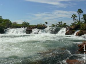
The target area of the Ecological Corridor Project in the Jalapao Region is located in the delineation of three major drainage systems at the regional and national levels: São Francisco, Parnaíba and Tocantins-Araguaia River. The river basin, are actually a river basin level(ANA, 2011), higher territorial participation in the study area is the Tocantins-Araguaia, with 47.48% of the total, followed by the region of Emotions, 32 25%, the remainder of the area located in the São Francisco river, with 20.17%.
The area of the river basin of the Rio Tocantins-Araguaia assisted in the project is located on its east-central portion, involving the river basin level 3 in Sono river and Manuel Alves river in some of its springs. The river basin of Emotions understands its southwestern corner, the region of the headwaters of Emotions, in the presenceof sub-basin level 3 of the Rio Balsas River and Black River-Uruçuí Gurguéia. In the fraction of the São Francisco River regions there is called "Medium / Low Big" tiny fraction of the region and "Great High", both belonging to the sub-basin of the Rio Grande, a tributary of the San Francisco River. According to ANA (2011), the main features of these three river basin districts are:
 • Tocantins-Araguaia river: has an area of 967.059km ² (11% of the country) and covers the states of Goiás (26.8%), Tocantins (34.2%), Pará (20.8%), Maranhão (3, 8%), Mato Grosso (14.3%) and the Federal District (0.1%). Much lies in the Central West, from the headwaters of the Araguaia and Tocantins rivers to their confluence, and hence, downstream, enters in the north to its mouth.Approximately 7.9 million people live in the river basin district (4.7% of national population), 72%in urban areas. The population density is 8.1 inhabitants / km ², less than half the national densityof 19.8 inhabitants / km ². Hydrographic Region of Tocantins-Araguaia Amazon biomes are present in the north and northwest, and other areas in the Cerrado;
• Parnaíba river: after the San Francisco River basin, the Hydrographic Region is hydrologically Parnaíba the second most important of the Northeast. It covers the state of Piaui and the states of Maranhao and Ceara. The region covers an area of 344.112km ², equivalent to 3.9% of the country, and drains almost all of the state of Piauí (99%) and part of Maranhão (19%) and Ceará (10%). The Parnaíba has about 1,400 km long and most of its tributaries are located downstream from Teresina are perennial and supplied by rainwater and groundwater. The main tributaries of Parnaíba river, are Poti, Portinho, Canindé, Piauí, Longa, Balsas, and Uruçu-Preto and Gurguéia. The three last mentioned rivers are included in the Project area;
• São Francisco river: essential by the volume of water transported to the Semi-Arid Region of the San Francisco Hydrographic covers 521 counties in six states: Bahia, Minas Gerais, Pernambuco, Alagoas, Sergipe, Goiás, and the Federal District. With 2,700 km, the San Francisco River rises in the Serra da Canastra in Minas Gerais, and flows in a south-north from Bahia and Pernambuco, when you change your course to the southeast, reaching the Atlantic Ocean at the boundary between Alagoas and Sergipe. The drainage area covers 8% of the country and its vegetation includes fragments of Cerrado in headwater areas, the central portion Caatinga and Atlantic Forest in the area of your mouth. 25.795Mw of hydroelectric potential of the inventory, 10.395Mw are effective through the mills of Tres Marias, Queimado, Sobradinho, Itaparica, Paulo Afonso and Xingó Complex. The main tributaries of the San Francisco river, are Paraopeba, Abaeté, Rio das Velhas, Jequitaí, Paracatu, Urucuia, Verde Grande, Carinhanha, Corrente and Rio Grande, the latter being the tax inserted in the region studied.