The Cerrado biome covers approximately a two million km2 area, situated between the coordinates 5˚ and 20˚ south latitude and 45˚ to 60˚ degrees west longitude, with most of its area located in the Central Plateau of Brazil. Cerrado regions extends continuously through the states of Goiás, Tocantins, Federal District, part of the following states: Bahia, Ceará, Maranhão, Mato Grosso, Mato Grosso do Sul, Minas Gerais, Piauí, Rondônia and São Paulo and, separate areas in the following states: Amapa, Amazonas, Pará and Roraima, and in the south the state of Paraná (Ribeiro & Walter, 1998). Historically, the Cerrado vegetation is conditioned by the climate, soil physical and chemical properties, fire, water table depth and more recently by human activities such as livestock, deforestation and agriculture (Ribeiro & Walter, 1998 apud FUNATURA, 2011).
 The concept of "Cerrado" has been used to designate either phytophisiognomy types (vegetation types) and to define phytophisiognomy formation or categories (vegetation forms). It can also be associated to the particular structural or floristic features, found in specific regions. Cerrado biome vegetation features physiognomies formations that include forest, savanna and grassland (RIBEIRO & WALTER, 1998). EITTEN Second (1994, apud RIBEIRO & WALTER 1998) the remaining Cerrado physiognomic forms depend on three aspects of the substrate: fertility and aluminum content available (low fertility, high aluminum levels); soil depth; water saturation level of the surface layers and subsurface soil. In the region of Jalapão region Ecological Corridor Project, Cerrado vegetation types are as follows:
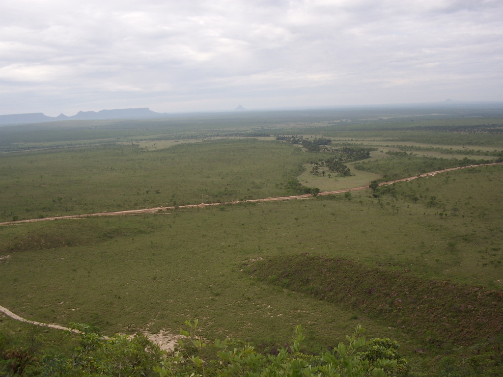
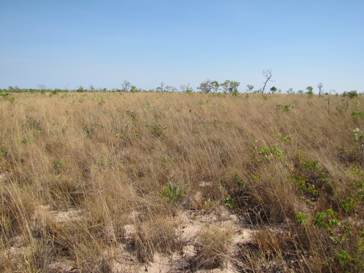
The Cerrado stricto sensus is characterized by the presence of low, bowed, crooked, and twisted trees with irregular branches, and usually with evidence of forest fire. Shrubs and subshrubs are scattered, with some species showing underground perennial organs (xylopodium), allowing the regrowth after cutting or burning. In the rainy season and herbaceous subshrub stratum become lush due to its rapid growth.
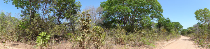
Figure 1 - Stricto Sensus Cerrado, located on Jalapão State Park.

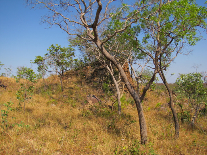
Figure 2 - Portion of Cerrado stricto sensus located Bahia, in the vicinity of the Serra Geral do Tocantins Ecological Station, Tocantins.
The trunks of woody plants often feature a husk with a thick bark, split or grooved, and the apical buds of many species are protected by dense pubescence. The leaves are usually stiff and leathery. These features provide aspects for adapting to dry conditions (xeromorphic). Due to the complexity of its conditioning factors, originate from different subdivisions of Cerrado stricto sensus physiognomic, the main ones being Dense Cerrado, Typical Cerrado and Cerrado Ralo (thin), and Rocky Cerrado.
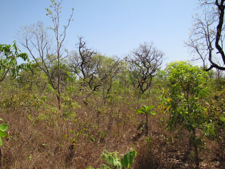
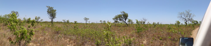
Figure 3 - Cerrado Stricto Sensus - SR, located in the Jalapão APA, TO.
Campo Sujo (Dirty Field) it is a exclusively shrubby herbaceous physiognomic type, with sparse shrubs and subshrubs, whose plants, some times are composed by individuals less developed from the Cerrado arboreal stricto sensus.
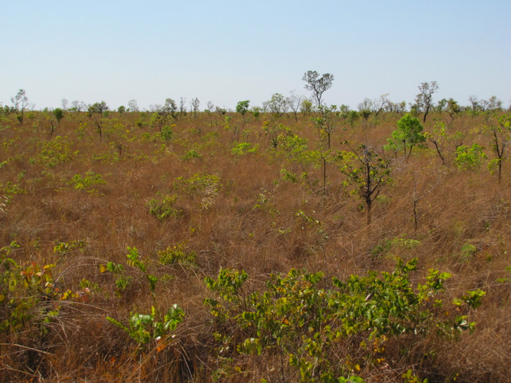
Figure 5 - Campo Cerrado Sujo, APA Jalapao, near the road Mateiros - São Fêlix do Tocantins, Tocantins.
Cerradão is a forestall formation with xeromorphic (resistant to the drought season), it has been know by the name of “ Xeromorphic Forest”, typified as being a “more sparse and weak forest” (RIZZINI, 1963; CAMPOS, 1943, apud RIBEIRO & WALTER, 1998). It featured by the presence of species that occur in the Cerrado stricto sensus and also by species from the forest. From the physiognomic point of view Cerradão is a forest, but floristically it is more similar to a Cerrado. Cerradão presents a canopy predominantly continuous and its arboreal cover may oscillate between 50% to 90%. The average height of the arboreal stratus varies from 8 to 15 meters, proportionating luminosity conditions that may benefit the differentiated shrubs herbaceous stratus.
According to the soil fertility, Cerradão may be classified as Dystrophic Cerradão (poor soils) or Mesotrophic Cerradão (richer soils), each of them boasting characteristic species adapted to these environments.
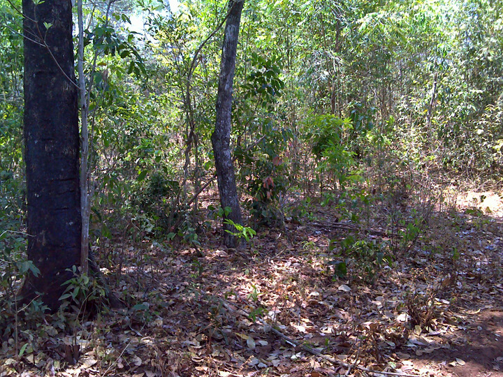
Figure 8 - Cerradão, unidentified at Nascentes do Rio Parnaíba National Park, MA.
Cerrado Rupestre (Rocky Cerrado) is a subtype of arboreal-shrubby vegetation, which occurs on lithic rupestrian environments or rocky (outcrop areas). It comprises a variable arboreal cover from 5% to 20%, average height between 2 to 4 meters with an herbaceous-shrubby stratus also highlighted. It may occur on continuous sections, including other vegetation types. It comprises a similar structure to Cerrado Ralo and a easy differentiable subtract, once it holds a little soil between the outcrop. Its lithic soils are originated from the decomposition of arenite and quartzite , poor on nutrients, acids, presenting also low content organic matter. On Cerrado Rupestre the arboreal individuals are concentrated on rock slits, and the density is variable and it depends on the soil volume. There are cases that trees may dominate the landscape, while others the herbaceous-shrubby flora predominates; but even with the presence of tress (RIBEIRO & WALTER, 1998).
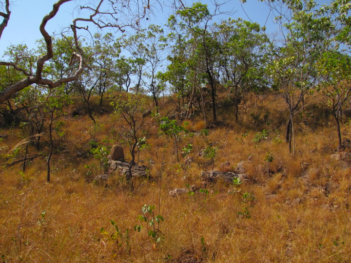
Figure 10 - Cerrado Rupestre, Nascentes do Rio Parnaíba National Park, MA.
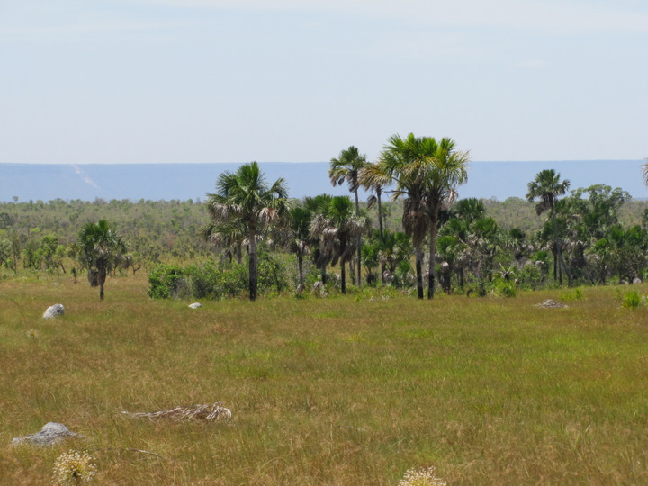
Vereda is a phytophisiognomy with emergent Buriti palm (Mauritia flexuosa), surrounded by groups shrubby-herbaceous species somehow dense. The Veredas are surrounded by Campo Limpo (clean field) usually wet, and the Buriti trees do not form a canopy, as happens on a Buriti field. On Veredas the Buritis feature an average height of 12 to 15 meters and the cover varies between 5% to 10%. Veredas are found on hydromorphic soil almost all year round. Usually they occupy valleys or plain areas following drainage lines poorly defined, normally with no murundus. They are also usual on intermediate position of the land, close to springs (place where water wells up from an underground), or on the border of Mata de Galeria (Gallery Forest). The occurrence of Veredas are conditioned to the upwelling water table (phreatic), resulting from layers of different permeability on sedimentary areas of the Cretaceous and Triassic (RIBEIRO & WALTER, 1988). The Veredas play a key role on the maintenance of Cerrado fauna, since they serve as landing place for the avifauna, refuge, shelter, food source and reproduction place for the terrestrial and aquatic fauna as well.
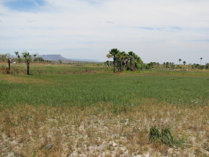
Figure 12 - Vereda, Serra Geral do Tocantins Ecological Station, TO.
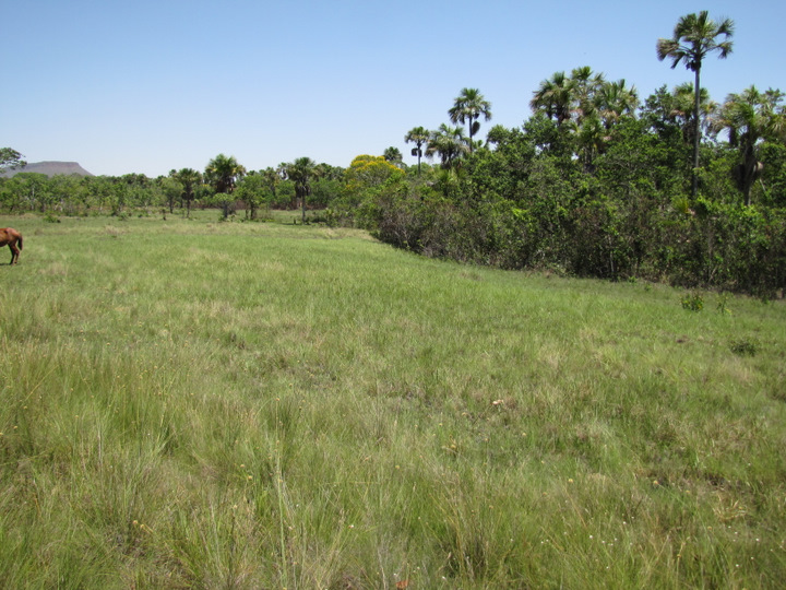
Figure 13 – Vereda, Jalapão State Park, near to Mumbuca Community, TO.
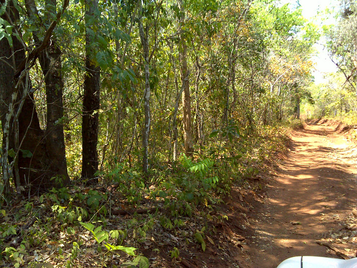
According to the definition Riparian Forest may be subdivided into two categories. Ciliary Forest and Gallery Forest. Ciliary Forest is defined as the forest vegetation that follows the medium and large size rivers on Cerrado region, where the trees vegetation do not form galleries. Usually this forest is relatively narrow on both side banks hardly longer than 100mts width on each side. It is common the width on each side to be proportional the river side banks, although the plain areas the width is larger. However, the Ciliary Forest occur normally on the rugged terrain, it may have a transition not always evident to other forestall physiognomies such as Mata Seca (Dry Forest) and Cerradão.
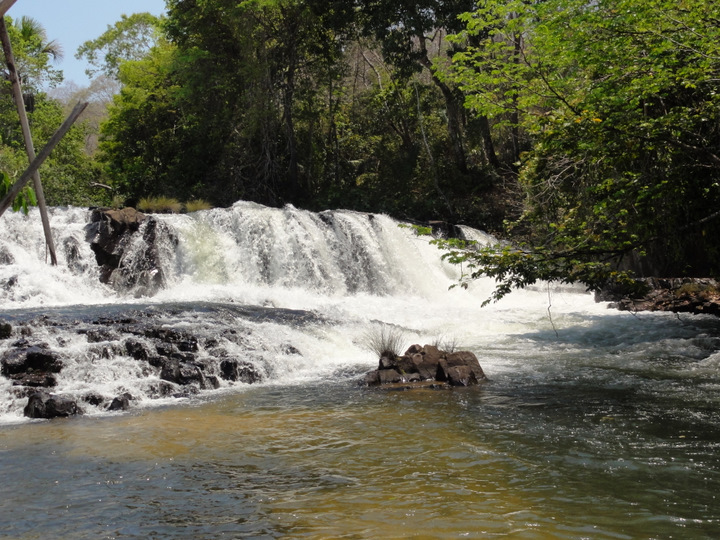
Figure 14 – Riparian Forest, Parnaíba River, Nascentes do Rio Parnaíba National Park, MA.
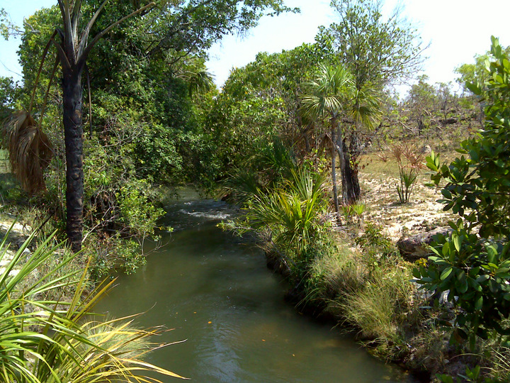
It is understood that Mata de Galeria is the forestall vegetation that accompany the small size rivers and streams on the plains of Central Brazil, creating closed long corridors (galleries) on the watercourse. Generally, Mata de Galeria is located at the back of valleys or on the headwater drainage, where the water courses have not dug a definite channel yet. This physiognomy is evergreen (deciduous), i.e. does not feature the falling of leaves on the drought season. Mata de Galeria is mostly surrounded by non-forest vegetation strips on both sides, and usually occurs an abrupt transition with savanna and campestral formations. This transition is barely noticed when it occurs with Matas Ciliares, Matas Secas, or even Cerradões large Cerrado, which is rarer, although differentiated by floristic composition.
The average height of tree layer varies between 20 and 30 meters, with an overlap of tree crowns that provide coverage from 70% to 95%. Inside, the relative humidity is high even during drought season. The presence of trees with small sapopemas (tabular expansions found in the stems of some trees) or protusions on the roots are common, especially in more humid areas. It is common to many species epiphytes (plants that support themselves on the structure of other plants, without parasite it), especially Orchidaceous, in a superior quantity of what occurs in other forest formations of Cerrado.

Figura 16 - Riparian Forest, Rio Parnaíba, Nascentes do Rio Parnaíba National Park, MA.
Under the denomination Mata Seca are included the dry forest formations featured by various levels of deciduous (trees or shrubs that lose their leaves seasonally) during the drought season, dependent on chemical and physical conditions, and especially the depth of the soil. The Mata Seca has no association with watercourses, occurring in interfluves (the region of higher land between two rivers that are in the same drainage system) in soils usually richer in nutrients. Due to the type of soil, floristic composition and, consequently, the leaves falling off in the dry season, the dry forest may feature three types: Evergreens Mata Seca, Semi-deciduous Mata Seca, the most common, and Deciduous Mata Seca. In all these subtypes the leaf falling off contributes for increasing the soil organic matter, even in the Evergreens Mata Seca. The average height of arboreal stratum varies between 15 and 25 meters. The vast majority of trees are erect, with some emerging individuals.
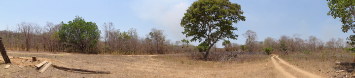
Figure 17 - Mata Seca, Nascentes do Rio Parnaíba National Park, MA.
On the target area under study, this phytophisiognomy features a little expression, however, it must be considered for the analysis, since it is vegetation significantly threatened by the deforestation, and it presents an immense biodiversity and environments richness.
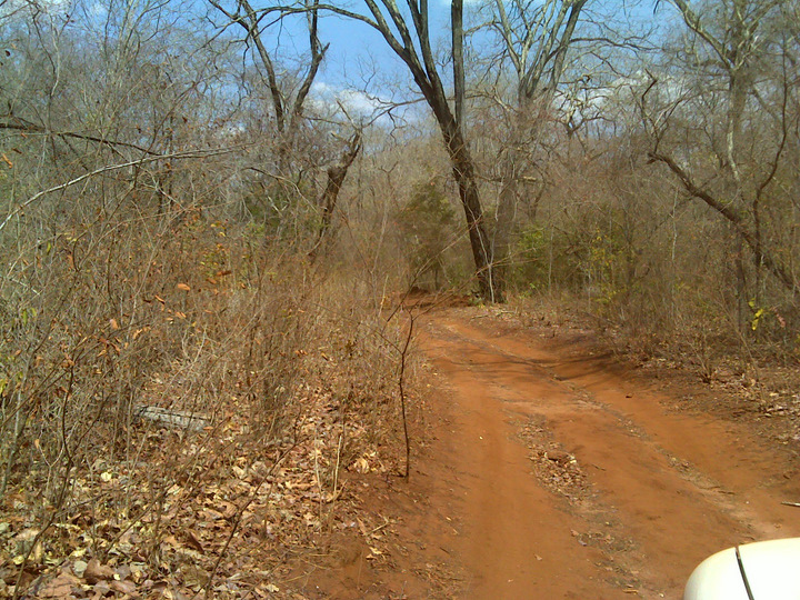
Figure 18 - Mata Seca, Parnaíba River Headwaters National Park, MA.
The Caatinga is characterized by xerophytic species vegetation, this is, vegetation that is adapted to arid climate, expressed by its expiry (leaf fall), because of its deep roots and the foliage adapted to retain moisture.

Figure 19 - Vegetation characteristic of Caatinga, located on the edge of a side road and a residence, Nascentes do rio Parnaíba National Park, MA.
")
")