Under the denomination Mata Seca are included the dry forest formations featured by various levels of deciduous (trees or shrubs that lose their leaves seasonally) during the drought season, dependent on chemical and physical conditions, and especially the depth of the soil. The Mata Seca has no association with watercourses, occurring in interfluves (the region of higher land between two rivers that are in the same drainage system) in soils usually richer in nutrients. Due to the type of soil, floristic composition and, consequently, the leaves falling off in the dry season, the dry forest may feature three types: Evergreens Mata Seca, Semi-deciduous Mata Seca, the most common, and Deciduous Mata Seca. In all these subtypes the leaf falling off contributes for increasing the soil organic matter, even in the Evergreens Mata Seca. The average height of arboreal stratum varies between 15 and 25 meters. The vast majority of trees are erect, with some emerging individuals.
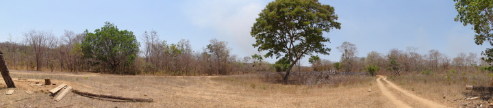
Figure 17 - Mata Seca, Nascentes do Rio Parnaíba National Park, MA.
On the target area under study, this phytophisiognomy features a little expression, however, it must be considered for the analysis, since it is vegetation significantly threatened by the deforestation, and it presents an immense biodiversity and environments richness.
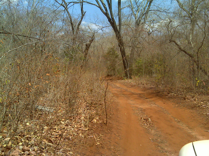
Figure 18 - Mata Seca, Parnaíba River Headwaters National Park, MA.
")
")